The Sea That Already Drained

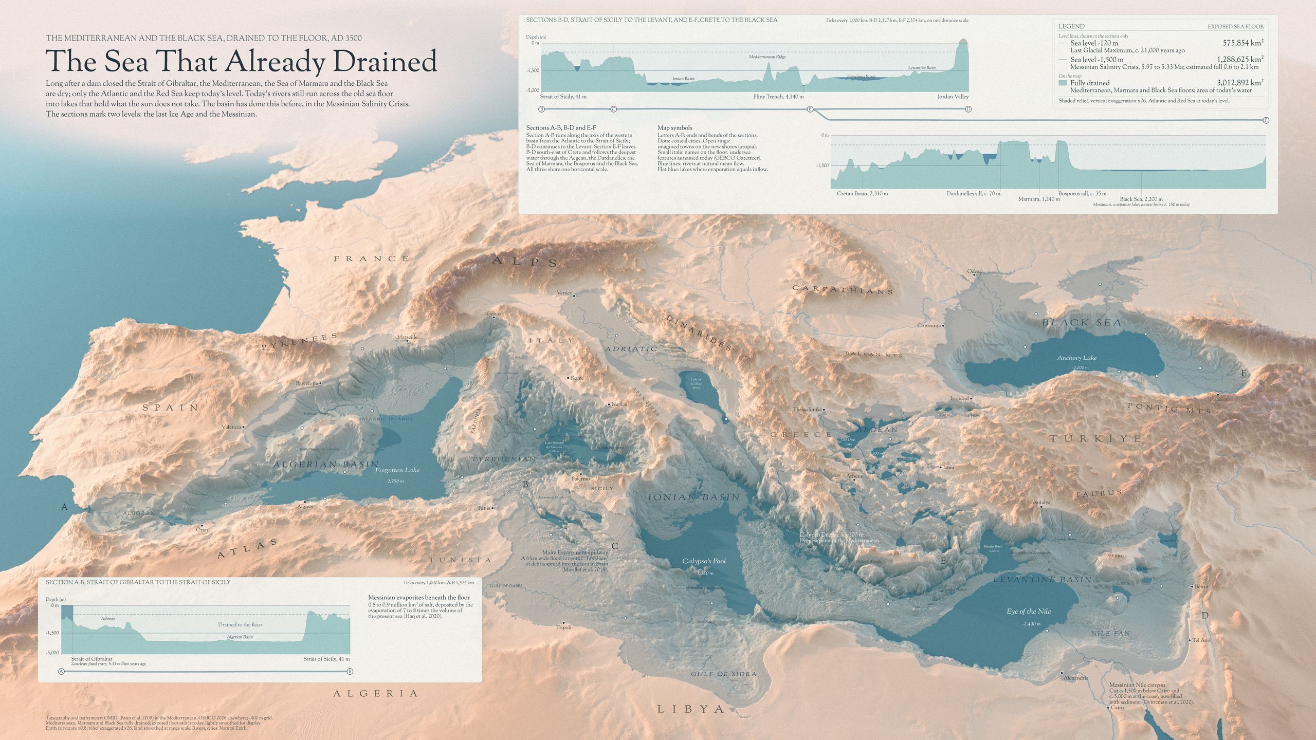
AD 3500: the Mediterranean, the Sea of Marmara and the Black Sea have dried out, and rivers run down the old slopes into lakes far below sea level.

8 November 2026 · Day 8: Utopia

Questions, something to add, or a thought you’d like to talk through? Write to me, I’d love to hear it.

Wide poster titled "The Sea That Already Drained": an oblique 3D view of Europe, North Africa and the Near East, north up, with the land in pale peach relief and the Atlantic as a flat blue-green surface on the left. Where the Mediterranean, the Sea of Marmara and the Black Sea were, the sea floor lies exposed in pale gray-green: escarpments, canyons and wide abyssal plains. Thin blue rivers run from today’s coasts down across the floor into flat, dark blue-green lakes in the deepest basins, labeled with imagined names and levels: Forgotten Lake -2,750 m off the Balearic Islands, Calypso’s Pool -3,350 m in the Ionian Basin, Rhodes Bowl -2,700 m, Eye of the Nile -2,400 m and Anchovy Lake -2,000 m in the Black Sea. Small open rings, without names, mark imagined towns on the new shores. Two framed panels hold depth sections along the drained floor, with lines at -120 m, -200 m and -1,500 m and a legend of exposed areas.
The Mediterranean and the Black Sea, dried out, AD 3500.

Drain it yourself

Drag the wall to drain the sea: south to north, then west to east.
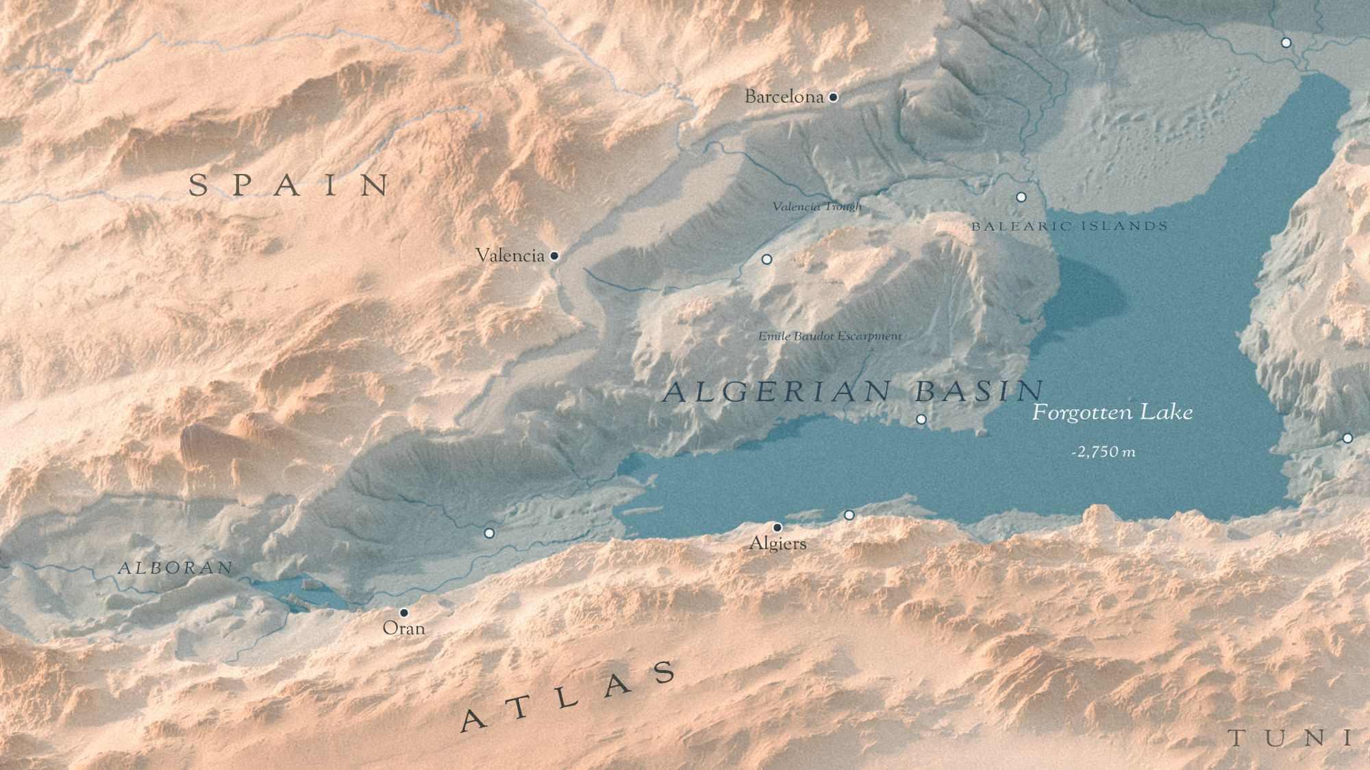
Close-up of the drained western basin in oblique 3D relief, from the Alboran Sea past Valencia and the Balearic Islands to Sardinia: a gray-green exposed floor between pale peach mountains of Spain and the Atlas. Rivers run down the old slopes into Forgotten Lake, a flat blue-green lake at -2,750 m in the Algerian Basin. Labels: Barcelona, Valencia, Oran, Algiers; the undersea names Valencia Trough and Emile Baudot Escarpment; small open rings mark imagined towns on the new shores.
The western basin, from the Alboran Sea to Sardinia.
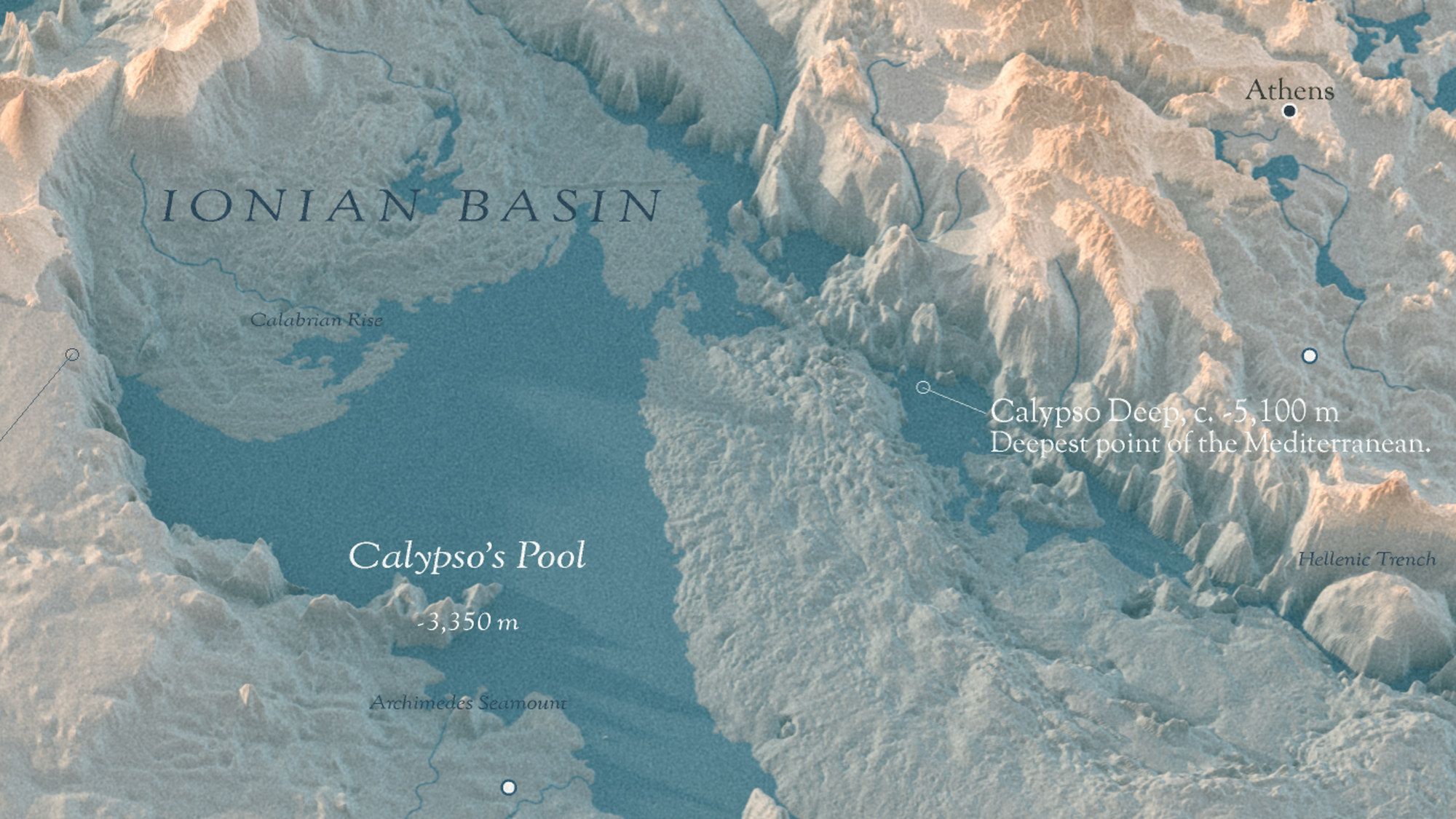
Close-up of the drained Ionian Basin in oblique 3D relief: a wide flat blue-green lake, Calypso’s Pool at -3,350 m, below the Calabrian Rise, with the Archimedes Seamount and the Hellenic Trench named in small italics. A leader marks Calypso Deep, about -5,100 m, the deepest point of the Mediterranean. Athens and the imagined towns Narrowpass and Thirstplain sit on the edges.
The Ionian Basin.

AD 3500. Long after a dam closed the Strait of Gibraltar, the Mediterranean, the Sea of Marmara and the Black Sea have dried out. Only the Atlantic and the Red Sea still stand at today’s level.

Rivers still run down the old slopes and gather in lakes far below sea level: Forgotten Lake at -2,750 m, Calypso’s Pool at -3,350 m, the Eye of the Nile at -2,400 m, and Anchovy Lake in the Black Sea at -2,000 m.

It is a utopia, but not a wild one. Between 5.97 and 5.33 million years ago the Mediterranean really did dry out, in the Messinian Salinity Crisis, and left salt up to a kilometer thick under today’s floor.
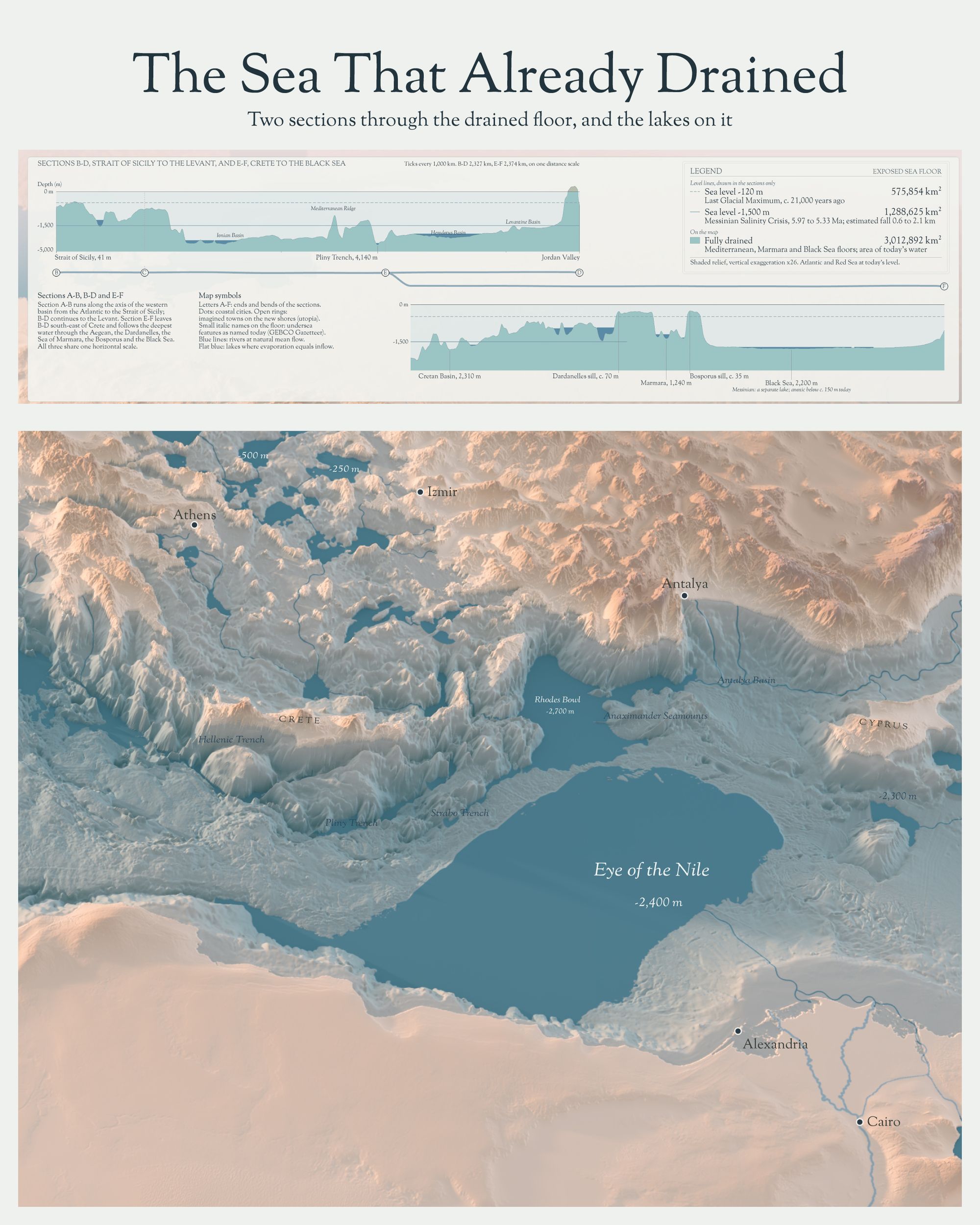
Second image under the same title, "Two sections through the drained floor, and the lakes on it": at the top the panel of depth sections B-D, from the Strait of Sicily to the Jordan Valley, and E-F, from the Cretan Basin through the Dardanelles, Marmara and the Bosporus to the Black Sea, with the legend of sea levels and exposed areas. Below, a close-up of the eastern basin: Crete and the Aegean with small lakes, and two large flat lakes, Rhodes Bowl at -2,700 m and Eye of the Nile at -2,400 m, with Athens, Izmir, Antalya, Alexandria and Cairo on the shores.
Sections B-D and E-F, and the lakes of the eastern basin. Full resolution

Data and method

The land and the sea floor come from real topography and bathymetry (GMRT, GEBCO). Rivers follow the terrain where it lets them; the lakes, the towns and their names are my own composition. The small italic names on the floor are real undersea feature names (IHO-IOC GEBCO Gazetteer).

References

Questions, something to add, or a thought you’d like to talk through? Write to me, I’d love to hear it.